The next named storm could be a monster hurricane in the Gulf of Mexico

[ad_1]
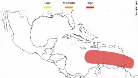
An area of disorganized activity over the southeastern Caribbean Sea will likely become the next tropical storm — named Hermine — in the next few days, according to the National Hurricane Center.
“The fact that nearly every computer model out there develops this into a westward-moving hurricane is absolutely concerning,” CNN meteorologist Chad Myers said.
So development is likely — but where it’s going is still somewhat up for debate.
“Well, there’s a lot of uncertainty right now,” Maria Torres, hurricane center spokesperson, told CNN on Wednesday. “But yes, it’s something that we are keeping an eye on and that we are closely monitoring as we get into the weekend and early next week.”
Over the next several days, the disturbance is forecast to move west-northwestward across the southern Windward Islands — at the Caribbean’s eastern edge — and then move toward the central Caribbean Sea later in the week, the hurricane center said Wednesday morning.
By late next week, both models show the storm entering the Gulf of Mexico.
On Wednesday morning, the American model showed the storm as a large and possibly major hurricane. It showed it making landfall in the Florida Panhandle by September 30. The European model had it hitting the southern section of Florida a day earlier — but as a much smaller, though nearly as intense a storm.
By Thursday morning, the model runs had shifted. The European model looks more like the American model from Wednesday, more intense and making landfall further up the west coast of Florida. It’s still forecasting a faster storm, meaning it would land September 29.
The updated American model from Thursday morning shows a much slower storm. It spins in the Gulf of Mexico for days, growing in size and then making landfall in Louisiana on Sunday.
It has been a slow start to what was forecast to be an above-average hurricane season. Only one storm has made landfall in a US territory, and no hurricane has made landfall or threatened the contiguous United States.
Now, a week past the peak of hurricane season, the tropics seem to have woken up, and forecasters are concerned people have let down their guard.
“After a slow start, the Atlantic hurricane season has ratcheted up quickly,” Phil Klotzbach, research scientist at Colorado State University, tweeted.
“People tend to lower their guard and think, oh, yeah, we’re out of the woods,” Torres said. “But in reality, the season continues. We are still in September; we still have October to go. Anything that forms over either the Atlantic or the Caribbean is something that we need to keep monitoring very closely.”
The Atlantic hurricane season ends November 30.
Four times a day, the American forecast model and the European model spit out an updated forecast. And after each run, meteorologists will tweet what they think will happen.
No matter what, if you live in the Caribbean, Florida and other states along the Gulf Coast, pay attention and watch what the National Hurricane Center says once the storm is strong enough to be named. The track that it issues at that time will give an increasingly good indication of what is most likely to happen.
[ad_2]
Source link